| LOCATION |
COVERAGE |
MAP |
COURSES AND FILES |
River corridor
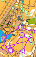
Upper Hutt |
Riverbank around Moonshine Bridge. |
OHV Park/sprint stds modified for MTBO 1:4000 at A4 Updated 2025 |
 Advanced Sprint MTBO course 9km with virtual barriers, and obstacles. Or it could be two beginner MTBO courses 3 and 6km For the 3km, download the North map. For the 6km, download the Mid map and the the South map. Or all three for 9km, just flow from one to the other. Starts in the Poets Park carpark off SH2 (vehicle entry and exit only available travelling north). Both are on MapRun as "MoonMTBO C1" or ...C2, but the combination is not. Read the legend carefully for allowable and forbidden features/colours you can use. Advanced Sprint MTBO course 9km with virtual barriers, and obstacles. Or it could be two beginner MTBO courses 3 and 6km For the 3km, download the North map. For the 6km, download the Mid map and the the South map. Or all three for 9km, just flow from one to the other. Starts in the Poets Park carpark off SH2 (vehicle entry and exit only available travelling north). Both are on MapRun as "MoonMTBO C1" or ...C2, but the combination is not. Read the legend carefully for allowable and forbidden features/colours you can use.
|
River corridor
Upper Hutt |
Riverbank with 200 trees and numerous native plantings |
OHV Park/sprint stds 1:4000/2500 at A4 Updated 2025 |
Start in Poets Park carpark north of Moonshine bridge. Compass practice 1.5km on an enlarged South map with every tree shown, and application on a 3km course on a North map among the native plantings with paths hidden. Shortcuts available.
|
Belmont Riverbank
Lower Hutt |
Primary school, park with rhododendron gardens, riverbank willows and native plantings. |
OHV Park/sprint stds 1:3,500 at A4
Mapping 2025 |
Start in Belmont School. Maps 2.3km yellow course, and 1.6km white course. |
Taita Cemetery
Lower Hutt |
Historic cemetery with many paths, steps and trees. |
OHV Park/sprint stds 1:2,000 at A4
Mapping 2025 |
Start near the western entrance in Kowhai St Naenae. Maps 1.5km course, and 0,9km course. Both dark yellow level, the path network is very complex. |
Civic Centre
Lower Hutt |
Civic buildings and gardens, plus Sacred Heart and St Peter and Pauls schools. |
OHV Park/sprint stds 1:3,500 at A4
Mapping 2025 |
Start at pedestrian crossing outside Sacred Heart College in Laings Rd. Maps 3km course, and 1.8km course. Both yellow level. Unless you seek permission please skip the controls in the (private) schools. |
Silverstream
Upper Hutt |
St Pats College campus and playing fields, farmland with riparian planting and tracks. |
OHV Park/sprint stds 1:3,500 at A4
Mapping 2025 |
Start at playground in Heretaunga Park, via Kiwi St. Maps 2.9km course, and 1.8km course. Both light orange level. |
River corridor
Lower Hutt |
Riverbank upstream from Kennedy-Good Bridge. |
OHV Park/sprint stds modified for MTBO 1:4000 at A4 Updated 2025 |
Two beginner MTBO courses 3-4km on one map: South map contains the starts, and North map contains the far end. Or its an advanced Sprint course with virtual barriers, and obstacles! C1 on the west side of the river starts behind Belmont School. C2 on the east starts on the river trail just north of the bridge. Both are on MapRun as "RiverbankNY2025C1" or ...C2. (NB some virtual barriers don't appear on the app, only on the pdf. Riverbed slow riding. River level can affect route choice.)
|
Parkway
Wainuiomata |
MTB Trail Park with passable bush and flat land being revegetated. |
OHV Park/sprint stds 1:3,500 at A4
Mapping 2022 |
Maps for 1.4km Yellow course, and 2.3km Yellowy Orange course. Start near the carpark at the end of Waiu St. |
Petone
Lower Hutt |
Bush tracks in steep but well-maintained park. Some off-track bush areas. |
OHV Park/sprint stds 1:2,500 at A4
Map tweaks 2024 |
Maps for 1.1km Yellow course, and 1.7km Yellowy Orange course. Start on the grass near the duckpond. |
Days Bay
Lower Hutt |
Bush tracks in extensive seaside park with duckpond, cafe, adjacent school. |
OHV Park/sprint stds 1:3,500 at A4
Mapping 2024 |
Maps for 1.8km Yellow course, and 2.7km Yellowy Orange course. Start near the pavilion. |
River corridor
Lower Hutt |
Riverbank from Melling to Kennedy-Good Bridge. |
OHV Park/sprint stds modified for MTBO 1:5000 at A4 Updated 2024 |
Beginner MTBO courses starting behind Belmont School: 3km Beginner course and 6km Intermediate course Map 1, and Map 2. Or its an advanced Sprint course with virtual barriers, and and obstacles! Both on MapRun as "BMax MKGB 2024 C1" (long) or C2 (short). (NB some virtual barriers don't appear on the app, only on the pdf. Some tracks indistinct. Riverbed unridable but can walk.)
|
Goldmine
Lower Hutt |
Native forest of Hayward Reserve on lower slopes of eastern hills. |
OHV Park/Sprint stds 1:4000 at A4
Mapping 2024 |
1.7km course as used for training Sep 2024. Red level. Start on Griffins Ridge, accessed from Wainui underpass or the end of Haywards Tce. Separate finish is at the end of Whites Line East. Download: Map file. |
River corridor
Lower Hutt |
Riverbank from Ewen to Melling Bridge. |
OHV Park/sprint stds modified for MTBO 1:5000 at A4 Updated 2024 |
Beginner MTBO courses starting north end of Riverbank Carpark: 1.5km Beginner course and 5km Intermediate course, or its an advanced Sprint course with virtual barriers, and real one-way zones and obstacles! Both on MapRun as "BMax Melling C1" or C2 as appropriate. (Some virtual barriers don't appear on the app.)
|
River corridor
Lower Hutt |
Riverbank from Ava Railway to Ewen Bridge, and part of Alicetown. |
OHV Park/sprint stds modified for MTBO 1:4500 at A4 Updated 2024 |
Beginner MTBO courses starting near East end Wakefield St: 1.5km Beginner course and 5km Intermediate course, or its an advanced Sprint course with virtual barriers. Both on MapRun as "BMax 11Aug2024 C1" or C2 as appropriate. (Virtual barriers don't appear on the app.)
|
Petone
Lower Hutt |
Park and beach as used in beginner MTBO. Also suitable for foot. |
OHV Park/sprint stds modified for MTBO 1:4000 at A4 Updated 2024 |
Start Hikoikoi Reserve. One map with 1km and 2km courses in different colours, C2 follows on from C1 and C3 is the combination: Hikoikoi B-Max 2024 C1 and 2 Maprun doesnt work for C3 - passing close to the finish circle will end recording. |
Petone
Lower Hutt |
Riverbank between Rail Bridge and river mouth incorporating Sladden Park and Hikoikoi Reserve. |
OHV Park/sprint stds modified for MTBO 1:6500 at A4 Updated 2024 |
5km easy MTBO course starting N side Waione St, cross carefully; finishes Hikoikoi Res. Map Hikoikoi B-Max 2024 C4 See also shorter courses above. |
Petone
Lower Hutt |
Sugarloaf |
OHV Park/Sprint stds 1:3300
Map update 2023 |
Orange courses as used for training exercise June 2023 and April 2024. 1km numbered controls plus two further loops using letters. Starts 120m up "The Bulldozer Track" at a track sign. Park in George Gee Dr, access via London Rd. Download map. |
Battle Hill RP
Pauatahanui |
Farmland near Transmission Gully |
OHV Forest stds 1:6000
Mapping ltd update, new contours 2024 |
Contour practice courses 1.5, 1.0 and 1.5km as used for training ex 2024. Start near top of Wetland Loop 1km from carpark. Map contains all three courses. Download Contour map, and Full colour map for use if help is needed. |
| Upper Hutt |
Town centre, St Josephs School |
OHV Park/Sprint stds 1:3333
Mapping 2019 |
Sprint courses 3.6, 2.1 and 1.0km as used for CSW competition 2024. Start in Lyster Lane carpark. Download Long course, or Short course, or Primary course. |
Belmont RP
Lower Hutt |
Belmont Bunkers area |
OHV Forest stds 1:5000
Mapping 2022 |
Yellow course 2.8km and white course 1.8km as used for CSW competition 2024. Start just north of farm hub (access not normally available for vehicles). Download Yellow course or White course. |
Kaitoke
Upper Hutt |
Kaitoke Campground and Rivendell bush tracks |
OHV Park/Sprint stds 1:3500
Mapping 2022 |
Yellow 2.9km and White 1.1km courses 3.2 and 2.2km as used for CSW classic competition 2024. Start near upper campground ranger station. Download Yellow course or White course. |
Petone
Lower Hutt |
Petone Rec and surrounding town centre |
OHV Park/Sprint stds 1:3000
Mapping 2022 |
Sprint courses 3.1, 2.0 and 1.3km as used for CSW competition 2024. Start near Buick St entrance. Long course has a map change: download Long Part 1 and Long Part 2, or Short course or Primary course. |
Trentham
Upper Hutt |
Upper Hutt College and Fergusson Intermediate |
OHV Park/Sprint stds 1:3000
Map update late 2022 |
Sprint courses 3.2 and 2.2km as used for CSW competition 2024. Start near gym entrance on Moonshine Rd. Both courses have a map change: download Long Part 1 and Long Part 2, or Short Part 1 and Short Part 2. |
Belmont
Lower Hutt |
Belmont Domain, school, and riverside |
OHV Park/Sprint stds 1:3000
Map update 2024 |
Two classic yellow courses 1 and 1.5km and a 500m school course, as used for Training in Feb 2024. Start on the riverbank behind the school. Download Domain course and both Riverbank and School courses. Note the riverbank course has some hard legs round the wetland which can be skipped. |
Petone
Lower Hutt |
Hikoikoi Reserve, beachfront, riverside |
OHV Park/Sprint stds 1:3000
Map update 2023 |
Orange course flat 4.2km as used for afterwork event Nov 2023. 2.6km and 1.6km sections available, see map. Start A Kirkcaldy St, Start B Marine Pade. Download both Map A and Map B. |
Belmont
Lower Hutt |
Kilmister Track |
OHV Forest stds 1:5000
Quick map update 2023 |
Orange course 2.2km/175m climb as used for orange training exercise Oct 2023. Accent on contours on steep country and trading off in/out vs down/up. Red may use map with tracks removed. Shortcuts available. Starts from the Hill Rd carpark. Download orange map, or red map. |
Petone
Lower Hutt |
Percy Reserve and Frank Cameron Park |
OHV Park/Sprint stds 1:2500-3500
Map update 2023 |
White and Yellow courses 1.5 and 2.0km beeline, as used for CSW Classic event. Best access from the main carpark off Dowse Dr, start near the cave. Download Yellow course, and White course. |
Avalon
Lower Hutt |
Avalon Park and Belmont Riverbank |
OHV Park/Sprint stds 1:3000-4000
Map update 2022 |
Three courses beeline 3.3, 2.4, 1.0km as used for CSW Have A Go day. Start near the mini golf at the end of Avalon Park Dr round the top/west side of the park. Download Orange course, Yellow course, and White course. |
Central
Lower Hutt |
Hutt Valley High School campus (flat) |
OHV Park/Sprint stds 1:2000
Map update 2023 |
Two courses beeline 1.3 and 2.1km as used for afterwork sprint. Start N side "Old Gym" near St Albans Grove entrance. Download Long course Part 1, Long course Part 2, and Short course. |
Naenae
Lower Hutt |
Old part Taita cemetery on hilly site with dense path network. |
OHV Park/Sprint stds 1:2000
Map check 2023 |
Two courses beeline 1.0 and 1.7km as used for afterwork sprint. Start near western entrance Kowhai St. Download Long course, and Short course. |
Belmont Regional Park
Lower Hutt |
Hilly farmland close to town. |
OHV Forest stds 1:5000
Mapping 2022 |
Five short loops from the shearers quarters, with contour-only map. Or combine the controls into a single longer course. Park at the Hill Rd carpark and walk up to bunkers 1.6km. Download contour map, and if desired a full colour map as a backup. |
Hayward Reserve
Lower Hutt |
Native bush close to town. |
OHV Park/sprint stds 1:2800
Mapping 2022 |
Short A to B course VERY red std (the area is steep and tracks are vague). Base yourself in Rishworth St, climb Griffins Ridge 220m to start, orienteer down. Download map. |
Stratton St
Lower Hutt |
Rural valley close to town. |
OHV Park/sprint stds 1:3000
Mapping 2022 |
Short A to B course yellow/orange std (the valley is narrow). Starts on Belmont Trig track, finishes woolshed. Give way to bikes on BMX track. South map, and North map, Print without scaling, or scale to fit A4 for further enlargement. |
UH College
Upper Hutt |
High school campus with wide balconies and stairs, using new map symbols for two levels. |
OHV Park/sprint stds 1:2500
Mapping 2022 |
Download the map. Print without scaling, or scale to fit A4 for further enlargement. Park in Moonshine Rd Upper Hutt. Follow the suggested course or just take a wander. Avoid school times. |
Manor Park
Lower Hutt |
Thin strip of bush along the Hutt River Trail. Construction may affect part from 2023. |
OHV Park/sprint stds 1:2750
Mapping 2022 |
Start on riverbank just south of Silverstream rail bridge. A to B course so park either near start or near entrance to Manor Park Golf Course. Maps: Main map, and Enlargement. for additional loops thu complex areas. About 2km, level orange due to closeness to trail, but red at speed. Mostly flat but some steep slopes. |
Wainuiomata
Lower Hutt |
MTB Trail Park with passable bush and flat land being revegetated. |
OHV Park/sprint stds 1:3500
Mapping 2022 |
Start at Waiu St park entrance. Maps: 2.5km course, and 1.7km course. Long orange with bush and climb, Short is yellow and flat. |
Haywards
Lower Hutt |
MTBO training course. One third forest tracks, one third new river trail, one third round Manor Park. |
MTBO stds 1:6000
Mapping 2022 |
Two map files: Map A, and Map B. It starts at the Manor Park Park & Ride carpark, accessed from the Haywards Interchange. |
Central
Lower Hutt |
Six bridges and underpasses, showing new map symbols for sprint events. Plus a circuit that connects them up. |
OHV Park/Sprint stds 1:2500 and Rogaine/MTBO stds at 1:12,000
Mapping 2022 |
Three map files for the bridges: Melling and Waterloo, Normandale and Woburn, and Ewen and Ava bridges. Print without scaling, or scale to fit A4 for further enlargement. Plus the connecting circuit, which starts at the N end of the riverbank carpark. NB (2024) The Melling Bridge course has been affected by construction activity, bypass this one. The 9km circuit is on MapRun as "Sharks Teeth..." BTW "ST" stands for the "Sharks Tooth" map symbols.
|
Avalon
Lower Hutt |
Avalon Park and riverbank around Belmont Domain; as used for primary school training session 2022. |
OHV Park/Sprint stds 1:1400-3000 at A4
Mapping 2022 |
Three map files: White Part 1, White Part 2, and two Yellow courses. When run, the mini train was not operating; if it is, go round the outside of the tunnel between 15-16.
|
Catchpool Stream
Remutaka Forest Park |
Well-formed bush tracks close to carpark; as used for CSW event 2022. |
OHV Forest stds 1:4000 at A4
Mapping 2019 |
The Forest Park is signposted from Wainuiomata, 10km down Coast Road. Start is adjacent to the upper carpark. Two map files: 2.4km Yellow course, and 1km White course. When first run, the white course was taped through the bush from control 7-9, beginner orienteers should miss out #8 and go round the outside of the bush.
|
Kaitoke Regional Park
Near Upper Hutt |
Camping area in rural setting; as used for CSW Have A Go event 2022. |
OHV Park/Sprint stds 1:3500 at A4
Mapping 2021 |
Regional Park is signposted from SH2, 10km N of Upper Hutt. Start in the lower camping area, on a track end NW of the ranger's house. The area is full of campers over summer. Two map files: 2km Yellow course, and 1.4km White course.
Yellow is on MapRun as "Kaitoke CSW 2022 Yellow PXAC". White is on MapRun as "Kaitoke CSW 2022 White PXAC".
|
Civic Centre
Lower Hutt |
Streets and parks and two schools; as used for afterwork Sprint event. |
OHV Park/Sprint stds 1:3500 at A4
Mapping 2022 |
Start in the NE corner of the Hutt Rec, just north of the astroturf area. Avoid school times. Two map files: 2.5km (beeline) Long course, and 1.6km (beeline) Short course.
Long is on MapRun as "Hutt Rec Sprint 2022 Long PXAC". Short is on MapRun as "Hutt Rec Sprint 2022 Short PXAC". Distances actually run may be 20-30% longer than beeline.
|
Waiwhetu
Lower Hutt |
Streets and parks mostly east of the railway, from Bell Park to Trafalgar Park; as used for E-Sprint event. |
OHV Park/Sprint stds 1:5000 at A4
Mapping 2022 |
Start in the triangular park adjacent to the Massey Ave Bowling Club. Avoid school times. Three map files: 5.2km (beeline) Long course Part 1, Long course Part 2, and 3km (beeline) Short course.
Long is on MapRun as "E-Sprint 2022 Long PXAC". Short is on MapRun as "E-Sprint 2022 Short PXAC". Due to no-go zones, distances actually run are about 50% longer than beeline.
|
Trentham
Upper Hutt |
Fergusson Intermediate and Upper Hutt College; as used for AW sprint event. |
OHV Park/Sprint stds 1:3100 at A4
Mapping 2022 |
Start in carpark of Fergusson Intermediate Hikurangi St. Avoid school times. Three map files: 2.6km (beeline) Long course Part 1, Long course Part 2, and 1.5km Short course.
Long is on MapRun as "UH College 2022 Long PXAC". Short is on MapRun as "UH College 2022 Short PXAC". On both you need to avoid passing within 15m of the finish, planning was not done with MapRun in mind.
|
Petone
Lower Hutt |
Area round Petone Rec, btwn Udy and Jackson Sts; as used for AW sprint event. |
OHV Park/Sprint stds 1:3600 at A4
Mapping 2022 |
Start near Buick St entrance. Avoid school and church times. Two map files: 2.5km (beeline) Long course, and 1.6km Short course.
Long is on MapRun as "Petone Rec 2022 Long PXAC". Short is on MapRun as "Petone Rec 2022 Short PXAC". On both you need to avoid passing within 15m of the finish, planning was not done with MapRun in mind.
|
Riverbank
Lower Hutt |
Mix of complex urban sprint terrain and passable riverside bush. |
OHV Park/Sprint stds 1:2750 at A4
Mapping 2022 |
4.1km (beeline) course starts at the river end of Market Gr.
Download Map A and
Map B. Construction activity is occurring in the high school but is up to date as at the start of Term 1 2022. Course is on MapRun as "NOTtheSCS2022" as S, F and two controls only but should track routes and give your time. |
Korokoro
Lower Hutt |
Bush tracks and hill suburbs with plenty of climb. |
OHV Rogaine stds 1:10,000 at A4
Mapping 2021 |
60min mini rogaine as used in
The Big Trig 2021, starts at Frank Cameron Park.
Map Percy Plus 2021
Also Control list/questions. Track and vegetation changes are always occurring but its in good shape.
Caution narrow track SE of #27, and steep track round waterfall west of #41. Rogaine is on MapRun as "BT2021Korokoro1hr" though GPS reception in the deep valleys is dodgy. It requires MapRun6. |
Silverstream
Upper Hutt |
St Pats College campus, farmland with riparian planting and tracks, riverbank and playing fields. |
OHV Park/sprint stds 1:4,000 at A4
Mapping 2021 |
Start at playground in Heretaunga Park, via Kiwi St. Maps 4km course, with shortcut options, and 1.9km course. Both light orange level. |
Trentham
Upper Hutt |
Trentham Memorial Park, playing fields, mature native bush with tracks, riverbank. |
OHV Park/sprint stds 1:4,000 at A4
Mapping 2021 |
Start at Trentham Memorial Park carpark off Brentwood St. Maps 3.2km course, and 1.7km course. Both light orange level. |
Naenae
Lower Hutt |
Lower part of reserve between Waddington Dr and the Summit Rd firebreak. |
OHV Park/Sprint stds 1:3600 at A4
Mapping 2021 |
Courses for DIY training: 2.5km Orange course, and
1.4km Yellow course.
Starts at un-named reserve between 8 and 20 Waddington Drive. |
Waiwhetu
Lower Hutt |
Lower part of Hayward Reserve and Te Whiti Riser. |
OHV Park/Sprint stds 1:3500 at A4
Mapping 2021 |
Course for DIY training: 2.5km Red course, starting at the playground
in Te Whiti Park, Whites Line East. |
Petone
Lower Hutt |
A triangle from Petone gateway to Hutt rivermouth to a bit north of Ewen Bridge. |
Rogaine map to OHV Rogaine stds 1:14,500 A4, six schools OHV Park/Sprint stds 1:1500-2000 A5
Mapping 2021 |
Courses used for mini urban adventure race of 2-3hr rogaine and six mini-sprints in schools 600-1200m. Starts at Carters Building Supplies behind Petone Pak N Save. Download: Rogaine map, and Hutt Central and HV High Schools, and Randwick and Wilford Schools, and Petone Central Sch and Hikoikoi Res. Rogaine is on MapRun as "SprintAR6 Rogaine". |
Belmont RP
Lower Hutt |
Low visibility native bush, areas with few tracks. Challenging practice area for advanced orienteers. |
OHV Park/Sprint stds 1:4000 at A4
Mapping ongoing |
Courses used for a U-Max in May 2021. Starts in the cul de sac off Miromiro Rd. Download: Warmup C1 in the track maze with tracked and trackless versions, suggest fold one away. And Difficult C2 and in-between C3 away from the track network. C3 finishes Oakleigh St carpark. |
Days Bay
Lower Hutt |
Bush tracks in extensive seaside park with duckpond, cafe, adjacent school. |
OHV Park/Sprint stds 1:4000 at A4
Minor update 2021 |
Courses as used for a CSW "sprint" in Mar 2021. Starts in Williams Park near the Pavilion. Download: 2.1km Long course, and 1.6km Short course |
| Hutt River corridor |
4WD tracks, vegetation mazes, riverbed and overgrown tracks in riverside vegetation between Melling and Ava Rail bridge |
OHV Park/Sprint stds converted to MTBO stds.
Mapping 2021 |
7.5km course as used for MTBO sprint training Mar 2021. Includes 4 areas with extra intense navigation. Starts Melling Bridge, finishes N end Riverbank carpark. Note (2024) The Melling Bridge area has been affected by construction activity; leave out controls 1-8 and 43-49. Download: Map A (1:2500), and Map B (1:5000), and Map C (1:5000), |
Wainui Trail Park
Wainuiomata |
Native bush around the Wetland Loop |
OHV Park/Sprint stds 1:3600 at A4
Mapping 2021 |
2.6km course as used for a HVHS Orange level training session Mar 2021. Starts at the WTP carpark. Download: Map file. |
Percy Reserve
Lower Hutt |
Bush tracks in well-maintained park. Steep. |
OHV Park/Sprint stds 1:2500 at A4
Last big update 2016 |
Courses as used for a CSW "sprint" in Mar 2021. Starts near the main carpark off Dowse Dr. Download: 2.4km Long course, and 1.9km Short course |
Jubilee Park
Lower Hutt |
Bush tracks in delightfully abandoned park. Steep. |
OHV Park/Sprint stds 1:2500 at A4
Last big update 2016 |
Courses as used for a CSW "sprint" in Feb 2021. Starts above the park in Normanale Rd. Download: 1.9km Long course, and 1.7km Short course |
Graces Stream
Wainuiomata |
Native forest with variable passage, bush camping area |
OHV Park/Sprint stds 1:3333 at A4
Mapping 2019/21 |
2.7km course as used for the Waitangi Shorts Feb 2021. Red level. From Lower Hutt pass through Wainuiomata and its 10km down Coast Rd, signposted Remutaka Forest Park. Then 2km to upper carpark. Download: Map file. |
Wainui Trail Park
Wainuiomata |
Mature beech forest |
OHV Park/Sprint stds 1:3000 at A4
Mapping 2019/21 |
1.7km course as used for the Waitangi Shorts Feb 2021. Red level. Not the usual WTP entrance: start at end of Kaponga St Wainuiomata. From Lower Hutt cross Wainui hill, left at roundabout into Parkway, left at roundabout into Mohaka St, 6th left into Kaponga St. Download: Map file. |
Dry Creek
Lower Hutt |
Riverside willows, highway interchange plantings, regional park entrance. |
OHV Park/Sprint stds 1:3333 at A4
Mapping 2019/21 |
3.8km course as used for the Waitangi Shorts Feb 2021. Orange level. Start thru Dry Creek culvert from the Belmont Regional Park entrance, which is in Hebden Cres off the west side of the SH2/SH58 highway interchange. Download: First map, and Second map. |
Goldmine
Lower Hutt |
Native forest of Hayward Reserve on lower slopes of eastern hills. |
OHV Park/Sprint stds 1:3750 at A4
Mapping 2021 |
1.9km course as used for the Waitangi Shorts Feb 2021. Red level. Start at Rishworth St, opp Flight Plastics at base of Wainui Hill Rd, Lower Hutt. Separate finish is 1.4km flat walk thru streets. Download: Map file. |
Petone
Lower Hutt |
Industrial part of Petone west with commercial premises and big-box retail carparks. |
OHV Park/Sprint stds 1:3000 at A4
Mapping 2021 |
4.3km course as used for the Waitangi Shorts Feb 2021. Start at Carters Building Supplies, Petone. From Petone Esplanade or Jackson St use Te Puni St to get into Annie Huggan Gr. Download: First map, and Second map. Unsuitable during business hours but Carters doesn't open on Sundays.
|
Rivendell
Upper Hutt |
Primeval native forest in Kaitoke Regional Park, limited off-track, Rivendell film set. |
OHV Park/Sprint stds 1:3000 at A4
Mapping 2019/20 |
2.0km course as used for the Waitangi Shorts Feb 2021. Orange level. Start at Rivendell carpark, Kaitoke Regional Park (turn off SH2 at Waterworks Rd north of Upper Hutt.) Download: Map file
|
Tunnel Gully
Upper Hutt |
Passable pine trees, bush tracks, picnic area with every tree mapped. |
OHV Park/Sprint stds 1:3000 at A4
Enlargement 1:1500 at A4
Mapping 2019/20 |
3.1km course as used for the Waitangi Shorts Feb 2021. First 14 controls red level. Start Upper carpark Tunnel Gully Recreation Area (via Plateau Rd, turn off SH2 at Te Marua dairy north of Upper Hutt). Download: Main file, and Sprint enlargement.
|
River corridor
Upper Hutt |
Hutt Riverbank both sides from Totara Park to Birchville Bridge, as used for Sprint Adventure Race Nov 2020. |
OHV Park/Sprint stds 1:5000 at A4
Enlargements 1:3000/2500 at A4
Mapping 2020 |
Start Awakairangi Park near Totara Park Bridge (off SH2 at Upper Hutt). Three files cover the 10km main loop which was ridden without timing: Bike North, Bike Middle, and Bike South.
See also Planner's hints.
Two enlargement files cover 4X1km sprint sections: Foot courses A and B, Foot courses C and D. Foot A Harcourt Park; Foot B Birchville School and adjoining reserve (avoid during school hours); Foot C California Park; Foot D River bend at Maoribank.
See also Planner's hints.
|
Parkway
Wainuiomata |
Wetland Loop and nearby trails in Wainui Trail Park. |
OHV Park/Sprint stds with MTBO adaptions 1:4000 at A4
Mapping 2020 |
Starts at carpark at end Waiu St. Map file: 5km MTBO course, a good rider will take 30min. Event on MapRun as "Wainui Sep 2020 Course B". Bush-clad valleys are challenging for GPS accuracy so the app may not register every control but you will get a beep at most. For an easier 2.5km course, visit only: 1-3-5-6-9-10-12-14-15-16-17. For a longer challenge ask the Mapping Officer for a 60min score course (also on MapRun). |
Tunnel Gully
Upper Hutt |
Picnic area, bush tracks, tunnel. |
OHV Park/Sprint stds 1:4000 at A4
Mapping 2020 |
Starts at the middle carpark, access from SH2 via Plateau Rd, Two map files: 1.2km White course, and 2.3km Yellow course. |
Baring Head
Wainuiomata |
Baring Head part of East Harbour Regional Park; as used for MTBO. |
OHV MTBO stds 1:10,000 at A4
Mapping 2020 |
Start at cattlestop up hill from carpark. Map for 4.6km short course. Event on MapRun as "Baring Breeze Main" was set up as a score event. You may record extra controls, but will get a result regardless. |
Petone
Lower Hutt |
Area round Petone Rec, btwn Udy and Jackson Sts; as used for AW sprint event. |
OHV Park/Sprint stds 1:3000 at A4
Mapping 2020 |
Start near Buick St entrance. Two map files: 3.1km Long course, and 1.7km Short course. Long is on MapRun as "Perfect Petone Long PXAC". Short is on MapRun as "Perfect Petone Short PXAC". On both you need to avoid passing within 15m of the finish, planning was not done with MapRun in mind. |
Central L/H
Lower Hutt |
Lower Hutt CBD covering Hutt Rec to river, and Queensgate to Ewen Bridge; as used for CSW event. |
OHV Park/sprint stds 1:3000 at A4
Mapping 2020 |
Start N end Hutt Rec. Three maps: 3.3km Orange course (light orange), 1.8km Yellow course, and 1.2km White course. The courses are on MapRun as "CSW HAGDay 2020 Orange/Yellow/White PXAC". |
Central L/H
Lower Hutt |
Hutt Valley High School and riverbank up to Ewen Bridge; as used for AW sprint event. |
OHV Park/Sprint stds 1:3000 at A4
Mapping 2020 |
Start end St Albans Grove. Two map files: 3.1km Long course, and 1.7km Short course. |
River corridor
Upper Hutt |
Hutt Riverbank both sides from Moonshine to Totara Park Bridge, as used for Sprint Adventure Race Feb 2020.
Involves crossing the Whakatiki River (not always possible but fine at summer flows). Passage through suburb of Riverstone Terraces to avoid serious slips on part of the river trail. |
OHV Park/Sprint stds 1:5000 at A4
Enlargements 1:3000 at A4
Mapping 2020 |
Start Moonshine Park near Moonshine Bridge on SH2. Three files cover the 10km main loop which was ridden without timing: Bike North, Bike Middle, and Bike South. See also Planner's hints. Two enlargement files cover 4X1km sprint sections: Foot courses A and D, Foot courses B and C. Foot A riverbank under Riverstone Terraces; Foot B riverbank and bed south of Totara Park; Foot C boulder stockpile opp Whakatiki St; Foot D Poets Park. Foot D uses non-std mapping to create tree maze. See also Planner's hints. |
Central U/H
Upper Hutt |
Maidstone Park incl bush loop as used for UHCC Activation event. |
OHV Park/Sprint stds 1:3000 at A4
Mapping 2019 |
Start near artificial turf off Park St. Map: 1.3km "Medium" course. |
Maungaraki
Lower Hutt |
Oma Rapeti track maze in native bush, Belmont Regional Park, as used for AW sprint. Also known as Run, Rabbit, Run. |
OHV Park/Sprint stds 1:2500 at A4
Mapping 2019 |
Starts in short grove off Miromiro Rd. Highlights course 1.1km |
Silverstream
Upper Hutt |
St Pats College, including farmland to riverbank and Heretaunga Park, used for AW sprint event. |
OHV Park/Sprint stds 1:4200 at A4
Mapping 2019 |
Start near playground in Heretaunga Park. One of the long variations approx 4km, and the short course 2.2km. |
Korokoro
Lower Hutt |
Percy Reserve including Frank Cameron Park. |
OHV Park/Sprint stds 1:3000 at A4
Mapping 2019 |
Start end of Stanhope Grove. Two maps: 1.4km Yellow course, and 1.2km White course. |
Mt Victoria
Wellington |
Town belt tracks from Constable St to Palliser Rd. |
OHV MTBO stds 1:8000 at A4
Mapping 2019 |
5-6km Training course starts near bike skills area. Track building is a constant here. Mt Vic MTBO Train 2019 Event on MapRun as sequence cse "Mt Vic MTBO Train 2019" |
River corridor
Upper Hutt |
Hutt Riverbank both sides from Silverstream to Moonshine Bridge, as used for Sprint Adventure Race June 2019. |
OHV Park/Sprint stds 1:5000 at A4
Enlargements 1:3333 at A4
Mapping 2019 |
Start river end of County Lane, Silverstream. Four files cover the 10km main loop which was ridden without timing: Bike North, Bike Mid-north, Bike Mid-south, Bike South. See also Planner's hints. Two enlargement files cover 4X1km sprint sections: Foot Courses A and C, Foot courses B and D. Foot A St Pats College farmland; Foot B Trentham Memorial Park; Foot C Upper Hutt College and Fergusson Intermediate; Foot D part Keith George Park. See also Planner's hints. |
Parkway
Wainuiomata |
Wainuiomata Schools and Trail Park, as used in multi-sprint 2019. |
OHV Park/street stds 1:3000 at A4
Mapping 2018 |
Starts in college and trail park. Three map files: 1.7km course in college and primary sch, 1.8km course in trail park, and 2.0km course in college and intermediate sch. There are normally-locked gates between the college and int sch, between the int and prim sch, and between the college and prim sch. |
Silverstream
Upper Hutt |
Small industrial area with dense but passable streamside plantings. |
OHV Park/sprint stds 1:3700 at A4
Mapping 2018 |
Compass legs starting in un-named road near Welgas. Park on main road, gates have been installed after boy racers discovered the tarmac:-)) Full map from landfill entrance to Fergusson Dr, also substantial enlargement of the compass legs. |
River corridor
Lower Hutt |
Both sides of river from Ewen Br to Melling Br, as used in publicity event for GW Riverlink project. |
OHV Park/sprint stds 1:5000 at A4
Mapping 2019 |
Start riverbank carpark opp Andrews Ave. 2.9km course both sides of river, and 1.5km course city side of river. |
Korokoro
Lower Hutt |
Percy Reserve including Frank Cameron Park |
OHV Park/sprint stds 1:3333 at A4
Mapping 2019 |
AW sprint event starting at the entrance near the main carpark. 2.2km Long Course, and 1.3km Short Course |
Central U/H
Upper Hutt |
Maidstone Park incl CBD btwn railway and Fergusson Dr. Dips into bush tracks. |
OHV Park/sprint stds 1:4000 at A4
Mapping 2019 |
AW sprint event starting near petanque area. 3.0km Long Course, and 1.8km Short Course |
River corridor
Lower Hutt |
Hutt Riverbank west side from Belmont Domain to Manor Park, as used for Sprint Adventure Race August 2018.
Uses Hebden Cres (old main road) which has heavy traffic except Sundays. |
OHV Park/Sprint stds 1:5000 at A4 Enlargements 1:3000 at A4
Mapping 2018 |
Start Dry Creek entrance to Belmont Regional Park. Four files cover the 12km main loop which was ridden without timing: Bike North, Bike Mid-north, Bike Mid-south, Bike South. See also Planner's hints. Two enlargement files cover 4X1km sprint sections: Foot Courses A and B, Foot courses C and D. Foot A Keith George Memorial Park; Foot B Pomare Bridge west bank; Foot C Belmont Domain; Foot D Dry Creek park entrance. See also Planner's hints. |
River corridor
Lower Hutt |
Hutt Riverbank both sides from HVHS and Ewen Br to Belmont Domain and KG Bridge, as used for Sprint Adventure Race June 2018. |
OHV Park/Sprint stds 1:5200 at A4
Enlargements 1:3000 at A4
Mapping 2018 |
Start Lower Hutt's Riverbank carpark. Four files cover the 26-control 9km main loop which was ridden without timing: Bike North, Bike Mid, Bike South. See also Planner's hints. Two enlargement files cover 4X1km foot sprints: : Foot Courses A and C, Foot courses B and D. Foot A Hutt Valley HS; Foot B Melling Bridge west bank; Foot C Belmont School; Foot D Melling riverbank east side. See also Planner's hints. NB (2024) The circuit is affected by construction activity on the east bank from Melling to KG Bridge. Map is no longer accessible, and Map A (HVHS) has had some building changes. So pick out the good bits:-)) |
Catchpool Stream
Remutaka Forest Park |
Three small parts of native forest in the Catchpool Valley as used in "Multi-Short" 1hr+ workout. Variety of leg types and difficulty, suitable training. |
OHV Park/sprint stds 1:3333 at A5
Mapping 2018 |
The Forest Park is signposted from Wainuiomata, 10km down Coast Road. 3X1.5km courses: Area A near the gate; plus Area B near the carpark includes location map for all 3; and Area C 1km up Graces Stream |
| Eastbourne |
Southern Eastbourne (Muritai) from the cricket ground to Burdans Gate. Wide beach with many point features, streets, tiny sand-dune area. |
OHV Park/sprint stds 1:4000 at A4
Mapping 2018 |
6km U-Max course. Two files: Eastbourne South-North 2018 and Eastbourne South-South 2018 |
Brown Owl/Totara Park
Upper Hutt |
Harcourt Park, connects over footbridge to California Park. |
OHV Park/sprintt stds 1:4000 at A4
Mapping 2018 |
4km course, can short-cut to 2km. Map Harcourt Park 2018 |
Avalon
Lower Hutt |
Avalon Park, Belmont School and Domain.
Note a crossable zone of the river must be checked for safety OR marked out of bounds. |
OHV park/sprint stds 1:4000 at A4 Enlargement 1:2000
Mapping 2017 |
Main file has 19 control locations marked, make up a course or run a 30-min score event: Avalon Park 2017 Trees at #2 have gone, and expect changes to riverside vegetation.
Enlargement of playground end of Avalon Park contains 2 maps with half a course on each; 1.4km in total. See above map for a legend: Avalon Park 2017 The high fence 7-8 and 15-16 has gone, now flat grass. |
Petone
Lower Hutt |
Park and beach as used in Multi-sprint experiment. |
OHV Park/sprint stds 1:3333 at A4
Mapping 2017 |
2km sprint course suitable foot or MTB. Map Hikoikoi Multisprint C 2017 Map reas OK, a couple of X's have disappeared. |
Central U/H
Upper Hutt |
Maistone Park, includes the bush up the hill and the ridge behind. |
OHV Park/Sprint stds 1:6100 at A4
Mapping 2017 |
4.4km U-Max course starts near petanque area. Map Maidstone Park 2017 The green stripe round #12 has thickened up - omit. |
Avalon
Lower Hutt |
Riverbank and former Avalon TV Studio as used in Multi-sprint experiment 2017. |
OHV Park/Sprint stds 1:3333 at A4
Mapping 2017 |
2km sprint course suitable foot or MTB (mostly). Map Percy Cameron 2017 There's a new building midway along S-1, adj stopbank. Riverside vegetation always changing. |
Maungaraki
Lower Hutt |
Delightful valley a stone's throw from town, plus steep tracks thru native bush to Old Coach Road. |
OHV Park/sprint stds 1:5000 at A4
Mapping 2017 |
Short course contains hard off-track controls, not for beginners. Map Stratton Street 2017 There's a new DH track from a pylon, cutting leg 1-2 and 2-3 and finishing N of the number for 3. Track-makers prob have others on the go. |
Brown Owl/Totara Park
Upper Hutt |
Harcourt and California Parks and riverbank. |
OHV MTBO stds 1:4000 at A4
Mapping 2016 |
Short MTBO courses starting from carpark near the soundshell. Maps Harcourt MTBO 2016 C1 2km, and Harcourt MTBO 2016 C2 4.5km. The numbering on C2 carries on from C1 so you can do them end to end. On C2 the obvious route 22-23 passes too close to the finish and will end the run - suggest go thru the learn-to-ride area instead.
|
Karori
Wellington |
Karori Park with sports fields and forest, beginner tracks on flat and lower slopes, challenging tracks higher up. Cafe. |
OHV MTBO stds 1:4000 at A4
Mapping 2016 |
Short MTBO courses starting from carpark near Mud Cycles. Maps Karori Park MTBO 2016 C1 2km, and Karori Park MTBO 2016 C2 3km, or do them end to end. Event on MapRun "Karori B-Max 2016" as a score event. You may record extra controls, but will get a result regardless.
|
Normandale
Lower Hutt |
"Forgotten" park cut off by motorway. Overgrown tracks in native bush with old house sites. Some passable bush. | OHV Park/sprint stds 1:3500 at A4
2016 Mapping |
U-Max course starting in the little carpark west of the overbridge: Jubilee Park 2016 |
Central U/H
Upper Hutt |
Flat part of Maidstone Park, with kids playground, mature trees, model railway, playing fields. Super-detailed version with pretty-well every tree marked:-)) |
OHV Park/sprint stds 1:3500 at A4
Mapping 2015 |
Three-part course marked, choose length. Map Maidstone Park 2015 and enlargement. |
Central U/H
Upper Hutt |
Part Upper Hutt city centre, a maze of carparks, alleys and corners. As used for AW sprint event. |
OHV Park/sprint stds 1:3333 at A4
Mapping 2015 |
Start carpark off Queen St. Course with fixed-order section and some optional controls, fast runners would do in 20min. Map Part of Upper Hutt CBD 2015 |
Korokoro
Lower Hutt |
Bush tracks and hill suburbs with plenty of climb. |
OHV Rogaine stds 1:10,000 at A4
Mapping 2014 |
90min mini rogaine starts at Percy Reserve Carpark. Map Percy Plus 2014
Also Control list/questions. App has regular scoring but wrong lateness; not checked yet. Track and vegetation changes are always occurring but its in good shape. |
Island Bay
Wellington |
Streets and town belt from Berhampore to the south coast, Houghton Bay to Happy Valley. |
OHV Rogaine stds 1:15,000 at A4
Mapping 2014 |
2hr mini rogaine starts at Wakefield Park. Map Island Bay 2014
Also Control list/questions. App has regular scoring but wrong lateness; not checked yet. Track and vegetation changes are always occurring and the Tapu Te Ranga maarae burned down but still a nice challenge. |
Thorndon/Wadestown
Wellington |
Extensive bush tracks and off-track across steep slope. |
OHV Rogaine stds 1:9,000 at A4
Mapping 2014 |
1hr mini rogaine starts at Wellington Girls Coll. Map Tinakori 2014
Also Control list/questions. The steepness and tall vegetation will be a severe test for the GPS app, course not checked yet. Amazingly the 2011 rogaine checked out OK in 2020, but this one has more off-track controls. The GPS app uses regular scoring but the wrong lateness. |
Aro Valley
Wellington |
Streets and bush tracks in the town belt btwn Aro St and Brooklyn. |
OHV Rogaine stds 1:10,000 at A4
Mapping 2014 |
1hr mini rogaine starts at Central Park. Map Te Aro 2014
Also Control list/questions. GPS app scores all controls 20pts; not checked yet. |
Kaukau
Wellington |
Khandallah streets and bush tracks to top Mt Kaukau. |
OHV Rogaine stds 1:10,000 at A4
Mapping 2014 |
1hr mini rogaine starts at Onslow College. Map Kaukau 2014
Also Control list/questions checked 2020. Map is in good shape, just some new bike tracks have appeared. GPS app scores all controls 20pts. |
Melling
Lower Hutt |
Central Lower Hutt, over the river and into Jubilee Park. |
OHV Rogaine stds 1:12,000 at A4
Mapping 2013 |
1hr mini rogaine starting in the riverside carpark. Map Melling P-Max 2013 and Control list/questions checked 2020. GPS app scores all controls 20pts. Map OK considering its age - expect GPS to be dodgy in Jubilee Park. |
Alicetown/Woburn
Lower Hutt |
Eastern Petone and Woburn including the riverbank between the railway and Ewen Bridge. |
OHV Rogaine stds 1:12,000 at A4
Mapping 2013 |
1hr mini rogaine starting at Garden of Appreciation (near Sladden Park). Map Petone P-Max 2013 Also Control list/questions checked 2020. Riverbank vegetation is always changing but map is in reasonable shape. GPS app scores all controls 20pts. |
Trentham
Upper Hutt |
Riverbank incorporating Trentham Memorial Park, Fergusson Intermediate and Upper Hutt College. |
OHV MTBO stds 1:8500 at A4
Mapping 2013 |
Beginner MTBO courses starting Moonshine Park just S of toilet block: C1 1km, C2A 3km on one map Moonshine 2013. Ignore courses 2B and 2C as school rebuilding has changed the map. Event on MapRun as "Moonshine B-Max 2013" was set up as a score event. You may record extra controls, but will get a result regardless.
|
Belmont
Lower Hutt |
Hutt riverbank and Belmont hills near the bottom of Kelson. |
OHV rogaine stds 1:12,000 at A4
Mapping 2013 |
1hr mini rogaine starts at Belmont Hall. Map Belmont and Hills 2013
Also Control list/questions checked 2020. GPS app scores all controls 20pts. |
Maungaraki
Lower Hutt |
Belmont Regional Park down to the Korokoro dam, plus streets round the top of Maungaraki. |
OHV Rogaine stds 1:8000 at A4
Mapping 2013 |
1hr mini rogaine starts at park entrance. Map Oakleigh 2013 Also Control list/questions checked 2020. Extra challenges: major new tracks between start and stream are not shown - cntrls 1, 10 and 11 are on OLD tracks. Area 12-23-5 is tricky. And expect GPS accuracy to be worse down in the valley. Inexp'd rogainers stick to the streets. GPS app scores all controls 20pts. |
Central U/H
Upper Hutt |
Part Upper Hutt city centre, a maze of carparks, alleys and corners. |
OHV Rogaine stds 1:5000 at A4
Mapping 2013 |
1hr mini rogaine, runners will easily complete. Map Upper Hutt CBD 2013 Also Control list/questions checked 2020. Expect man-made changes to the map. And as the rogaine mapping is HUGELY enlarged the GPS app may not be accurately positioned. Correct scoring system but wrong lateness. |
Naenae
Lower Hutt |
Naenae east of the railway, streets and parks. |
OHV Rogaine stds 1:12,000 at A4
Mapping 2013 |
1hr mini rogaine starting at Naenae Park. Map Naenae 2013 Also Control list/questions checked 2020. GPS app scores all controls 20pts. |
Korokoro
Lower Hutt |
Korokoro including Percy Reserve and Galbraith Gully. |
OHV Rogaine stds 1:10,000 at A4
Mapping 2012 |
1hr mini rogaine starts at Frank Cameron Park. Map Korokoro P-Max 2012 Also Control list/questions checked 2020. Track beside waterfall is steep - do not attempt in dark. GPS app scores all controls 20pts.
|
Petone
Lower Hutt |
Eastern Petone including riverbank between the shore and the railway bridge. |
OHV Rogaine stds 1:12,000 at A4
Mapping 2012 |
1hr mini rogaine starting at Garden of Appreciation (near Sladden Park) Map Petone P-Max 2012 Also Control list/questions checked 2020. The map is reasonable, with one major change: the building complex around #2 is now a retirement home and private. There are some non-critical changes east of #25 between Jackson St and the stream. Riverbank vegetation is always changing. GPS app scores all controls 20pts.
|
Totara Park
Upper Hutt |
Totara Park and east side of river from the bridge to Harcourt Park. |
OHV Rogaine stds 1:12,000 at A4
Mapping 2012 |
1hr mini rogaine starting at riverbank carpark via Michigan Cres. Map Totara Park P-Max 2012 Also Control list/questions checked 2020. Map is in good shape. GPS app scores all controls 20pts.
|
Mt Victoria
Wellington |
First stage of Waitangi21 Multistage rogaine. |
OHV Rogaine stds 1:12,000 at A4
Mapping 2012 |
1hr mini rogaine. Map Mt Victoria 2012 has seen many new tracks but is basically right. Also Control list/questions checked 2020. GPS app correct scoring but wrong lateness. Choose 1 or 2 hours, the MapRun name ends in Q60 or Q120. |
Petone
Lower Hutt |
Area round Petone Rec incl Mitre 10 carpark, Weltec campus, school, church, library etc. |
OHV Park/sprint stds 1:4,000 at A4
Mapping 2012 |
Beginner course, no road crossings. Map Petone Rec 2012 has been updated since, but this is still pretty right. |
Avalon/Belmont
Lower Hutt |
Avalon west of High St, and the riverbank part of Belmont. |
OHV Rogaine stds 1:12,000 at A4
Mapping 2011 |
1hr mini rogaine starts at Avalon Park - carpark off Fairway Drive. Rerun 2019 with map Avalon P-Max 2011, but Control list/questions checked 2020. Mapping has stood up well, significant changes are: New playground; Sportshub - new bldg in Fraser Park; Riverside vegetation always changing. App scores all controls 20pts.
|
Central Hutt/Normandale
Lower Hutt |
Central Lower Hutt, over the river and into Jubilee Park. |
OHV Rogaine stds 1:12,000 at A4
Mapping 2011 |
1hr mini rogaine starting in the riverside carpark. Map Melling P-Max 2011 and Control list/questions checked 2020. GPS app scores all controls 20pts. Map OK considering its age - expect GPS to be dodgy in Jubilee Park.
|
Trentham
Upper Hutt |
Between Fergusson Dr and the river, from Trentham Park north to Whakatikei St. |
OHV Rogaine stds 1:12,000 at A4
Mapping 2011 |
1hr mini rogaine starting at Trentham Park. Map Moonshine P-Max 2011 GPS app scores all controls 20pts; not checked yet. Question sheet not available sorry.
|
Pinehaven/Silverstream
Upper Hutt |
Pinehaven and Silverstream. |
OHV Rogaine stds 1:12,000 at A4
Mapping 2011 |
1hr mini rogaine starting at Pinehaven Reserve. Map Pinehaven P-Max 2011 Also Control list/questions checked 2020. Map is in reasonable shape but deliberate offset of circles may put some beyond GPS reach - however the "review" process after your run should include them. GPS app scores all controls 20pts.
|
Thorndon/Wadestown
Wellington |
Tinakori Hill, now called Te Ahumairangi. |
OHV Rogaine stds 1:10,000 at A4
Mapping 2011 |
1hr mini rogaine starting at the top of Weld St. Proceeds went to our orienteering friends in Chch. Map Tinakori P-Max 2011 Also Control list/questions checked 2020. Many track and vegetation changes have occurred since 2011 but amazingly all controls but 1 have registered on the app. GPS app scores all controls 20pts.
|
Waterfront
Wellington |
Waterfront from Te Papa nearly to Rly Stn, and including the Civic Centre. |
Hobbit-style 1:4500 at AA
Mapping 2011 |
Course is the 2011 City Safari 10-minute Prologue. Map Wellington Waterfront 2011 Also Control list/questions. |
River corridor
Lower Hutt |
Riverbank from Melling Bridge to Kennedy Good Bridge. |
OHV MTBO stds 1:8500 at A4
Mapping 2010 |
Beginner MTBO course. Map Lower Hutt Riverbank 2010 |
River corridor
Upper Hutt |
Riverbank incorporating Harcourt Park to Totara Park Bridge. |
OHV MTBO stds 1:8500 at A4
Mapping 2010 |
Beginner MTBO course. Map Totara Park 2010 |
Moores Valley
Wainuiomata |
Scout camp. |
Old-style park stds 1:4000 at A5
Mapping 2009 |
2km course marked. Camp also has permanent marked course. Map Brookfield Scout Camp 2009 |
Moonshine
Upper Hutt |
Riverbank incorporating part of Trentham Memorial Park, Fergusson Int/Upper Hutt College and Poets Park. |
OHV MTBO stds 1:10000 at A4
Mapping 2009 |
Beginner MTBO course. Map Moonshine Park 2009 |
Trentham
Upper Hutt |
The former Central Inst of Technology, including army playing fields and Hutt Int Boys School. |
Old-style park stds 1:5000 at A4
Mapping 2008 |
Multi-loop O-Max course marked. Map C.I.T. 2008 |
 OHV MAPS