 OHV Mapping Conventions
Conventions have been developed for
There's another category that we haven't got conventions for yet. We aren't blessed with fast-running terrain but we do have native bush with tracks and little pockets of passable going. With honest advertising they are suitable for forest events. We think that the slow going makes 1:7500 about right. They are most like category 1, Maps for Traditional Foot-O.
1. Competition Maps for Traditional Foot-orienteering, to be printed at scales of 1:15,000 and 1:10,000
Not much to say here: follow the International Specification for Orienteering Maps! On the IOF website or get a nice colour booklet from the MAPsport Shop.
STOP PRESS! There's a new IOF mapping specification known as ISOM2017. This will have an effect on these maps, and on this section.
OCAD has symbol sets for both 15,000 and 10,000. We've generally used 1:15,000 but as most of our maps are printed at 1:10,000 we may change them over. The symbols are a 150% enlargement which is exactly the same as just printing larger.
A 1:10,000 map can be printed smaller (1:15,000 and the symbols will reduce in proportion) but the danger is that extra detail may have been squeezed in and it becomes unreadable. Take care. It is sometimes required to have 1:15,000 for elites and maybe course 2 and 1:10,000 for the others in consideration for their aging eyes. You can also do 1:7500 or 1:5000 for beginner courses, in which case the symbols will become bigger still.
There are one or two things that need to be changed when printing at these different scales.
Basemaps for these maps will normally come from commissioned photogrammetry, or from previous maps which have started as photogrammetry. Fieldwork is recommended at 1:7500 to prevent putting too much on the map. However there is a case for fieldwork at 1:5000 for those without perfect eyesight or using less than perfect basemaps, eg OCAD prints off a home printer.
2. Maps for MTB-Orienteering, Street and Park-Trail orienteering on Foot, and Small Rogaines, to be printed at scales of around 1:20,000
Background: The situation at 2004
Use the MTBO specifications and a scale of 1:20,000. But basically the urban area is a stick-to-the-tracks situation so the MTBO recommendations are fine for street events. The runners have shown no signs of even noticing!
There is a version of the MTBO specifications in the printed ISOM but there are later ones on the web, and there are one or two NZ recommendations. Link to these from the Mapping section of the ONZ website.
There are heaps of private areas in suburbia and neither the khaki green nor the vertical black stripes looks great when there is a lot of it. We have used a special colour 50% grey which is placed at the bottom of the colour hierarchy so that it can be drawn under the whole map. All other colours appear on top and when a boundary changes there may be one object to change rather than two adjoining objects. A byproduct is that white has to be explicitly drawn, it isn't just an absence of anything else as usual. That's OK, there isn't much of it.
There's sometimes a need to print at a larger scale in a detailed area (eg 15,000) or smaller scale if you want to cover a bigger area or keep the paper size down (eg 25,000). For larger scales you can just do it at the print stage (in which case the symbols will look bolder).
For smaller scales you CAN'T just print smaller as that would make the symbols too tiny. You have to "change scale" and uncheck the "enlarge/reduce symbols" box. The consequence of this is that close-together symbols cover a larger area on the ground and can overlap and blur together. An example is SH2 and the railway. Such areas have to be carefully drawn with this in mind if printing at a smaller scale is envisaged. We can probably get away with 25,000 but anything smaller is going to be problematic and inserts of detailed areas at a bigger scale are going to be needed.
There are one or two things that need to be changed when printing at larger scales. Text which is a good size for 20,000 (eg legend) will look larger when printed at 15,000. And you don't want larger circles and control numbers, so you need to define proportionately smaller circles etc so they enlarge to the right size at the print scale.
Basemaps for this mapping are usually the topo maps. We have got a big chunk of the region into OCAD as DXF files, one of the few formats that OCAD can import. They are royalty-free but we had to find someone who had the files to carve out the area required and to convert from other formats into DXF. This is not a trivial operation, and eventually our contact urged us to define the total area of interest, for a "big hit". We have obtained everything west of the Akatarawa Hill Road, and south of Waikanae, an area of about 1500sq.m. This had been carved up into half a dozen OCAD files, but all on the same coordinate system so that they fit together perfectly.
The origin of these files means the contours are 20m and don't have all the small reentrants etc, which is fine for MTBO, rogaines and street events. The mapping was meant for 1:50,000 and when enlarged to 20,000 you find that eg road bends are somewhat rounded. These can be improved, and other detail added, from aerial photos available on the LINZ website. These photos have had distortion removed and can be used as templates in OCAD. The resolution is a bit grainy for buildings but linear features show up well. We can also add details from conventional foot-o maps, taking care to prune the detail. Bear in mind that people are going to want to print at smaller scales even than the 20,000.
All of this means that we have been able to map large areas without going out on the ground. The track classifications have been added from our earlier maps where they exist, the memory of members, and by progressive visits when required for specific events. There is one aspect where the requirements of MTBO conflict with foot-o: vegetation. The MTBO specification says you can use both green or white for forest. Initally we did all forest medium green, as being more intuitive for bikers. Then the bikers started distinguishing "allowed off-track" with white. This is "sort-of" the same as passable forest for footies. It's a bit rough, but then if you want accurate foot-o then you have to do a traditional foot-o map. Over time we can "fill in" the forest where it is important. What isn't filled in with white or green or yellow will show as grey, the same as private or residential.
Since the white is drawn with a specific symbol rather than just being the absence of other colours, we sometimes change it to light green as being more intuitive for rogainers. And we have also started using dark green for areas that we want to warn people out of - terrible jungle on the way to a control point for example. Help, we could be getting too complex here!
Fieldwork is recommended at 1:10,000. We have some guidelines for course planners and explorers to report corrections: here.
Update: The situation in 2014
Some time in the noughties we started getting much better info.
Here are the files:
3. Maps of Parks and Reserves to be printed at scales of around 1:5000.
Background: The situation in 2004
Since this section was written, the IOF has published an "International Specification for Sprint Orienteering Mapping". Keep reading to find out about our conversion project.
Neither the ISOM 10/15,000 mapping nor the MTBO-standard mapping is suitable for parks, where there is heaps of interesting detail. Over the years we have mapped parks at 1:5000 or even larger. With park maps adjoining the riverbank now expanding to the point of overlap, we joined them all into a series of exactly abutting maps up the valley. They go from Eastbourne to Kaitoke, with topo data filling in the gaps. Other park maps outside this corridor might as well follow these conventions.
The scale chosen was initially 1:7500, so that we could cater for long yellow courses (by printing at 7500) as well as beginner white and yellow (by printing at 5000). Compared to the ISOM the 7500 scale provides 4X the paper area for a given ground area to show detail. So the cartographer should select 7500 as the scale in OCAD, and the 15,000 (standard) symbol set. And when printing at 5000 think about the smaller text and course marking symbols so that they will come out at the right (scale-independant) size. Include plenty of north lines.
The basemaps for these come from the 1:20,000 MTBO/street mapping above. This ensures that everything fits together properly. Previous maps of small areas have used dubious basemaps and photos with distortion, and particularly when expanding outwards the geometry is out of whack. For a new area the 1:20,000 mapping provides the framework, and fieldwork can be done on aerial photos from the councils. This fieldwork is then used in OCAD, adjusted to the framework which we have confidence in. The photos are not distortion-free and the scale is approximate, but as we deal with a small bit at a time, the OCAD template adjustment process takes care of it well enough.
Existing park maps are harder. The UHCC/LHCC photos are opened as templates and fitted to the framework and a bit of significant detail traced using temporary lines. Then the old maps are opened as templates and everything adjusted to the lines from the photos. If the old map is in OCAD already, it may be possible to bring it in chunk by chunk. It might be necessary to change its scale and rotate it a bit to get a good fit. Or it might be so distorted that everything has to essentially be redrawn. After such an exercise it needs to be checked in the field; it makes you wonder whether starting again might be easier!!!
Here are some of the conventions adopted for fieldwork so far. The starting point is of course the ISOM. We shouldn't be putting smaller features on the map; rather the opposite - because there are likely to be more features on the ground we may have to be stricter about what the minimum size is! This is especially the case for man-made objects.
Read the specific feature-by-feature guidelines here.
Update: The Situation in 2014
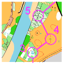
Our O-Max events had a lot to do with popularising the sprint discipline. Almost always done in an urban setting. People are now seeking out complex building and other "mazes", and we now need to convert some of our park maps to the sprint specification. At around the same time we cut up our riverbank maps into 14 slices so that different people could work on them independently. Maps across the valley floor were absorbed too. Here are the maps:
The sprint spec has two scales, 1:5000 and 1:4000. Our policy is to use 1:5000 as a filter on the amount of detail. If a map will fit on the page at a bigger scale then we will reap the legibility benefits. It is accepted that older eyesight justifies a 150% enlargement, that is, 1:3333 or so.
There is the same pressure to fit in lots of detail as there is in standard mapping. The equivalent of the tiny reentrant is the building alcove or internal corner. We take the thickness of the thickest line (impassable wall) as our minimum dimension to be taken notice of. This works out at 2m on the ground. So planter boxes under 2m, porches under 2m, canopies under 2m, DO NOT EXIST!
And this is a minimum. If there are too many features to fit, we use the Eric Andrews principle for rocky areas. Which rock puts its hand up and says "pick me"? That one goes on the map. Next? Next. When there isn't any more room, that's it. If nifty corners or planter boxes or alcoves don't fit then they don't go on the map. All mapping is a generalisation.
We have tailored our specific feature-by-feature guidelines to Sprint-Spec mapping here.
The sprint spec is oriented to the urban situation, and fairly flat terrain. We don't feel it suits parks away from the valley floor with a bit of elevation, and we will continue to use a version of the standard spec for these. We use the 1:10,000 version of the standard symbols, but a scale of 1:5000. The new aerial photos and 5m contours from the city councils will give them a better foundation, though it will take a while to merge the council contours with what has been fieldworked on the ground.
Read the specific feature-by-feature guidelines here.
4. Maps of Small Parks and Schools, to be printed at scales of 1:3000 and larger.
For smaller parks and schools, the area may be lost on an A4 or even A5 sheet. A large scale might as well be used and will be easier to read for beginners. These will be made by a variety of people, there is unlikely to be any overlap of them, so at this stage coordination is not justified. Do what you think is advisable. Some of the maps above may provide a base. The sprint specification is probably best. Examples are: