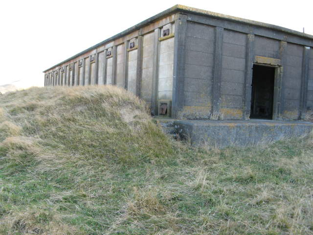
Belmont Bunkers
Mapping Notes, 2007

OHV has been orienteering in the bunkers area of Belmont Regional Park for 30 years.
One of its first colour maps (minus yellow) was of the bunkers area at the top of Hill
Road, Belmont. This evolved into the standard 5-colour map of 1986. This was put into OCAD
and for the last event in 2001 was slightly extended round the edges.
Meanwhile back in 1982 a b/w map of a much wider area was made, using stick-on "Letra-tone"
to create shades to represent vegetation. As there is very little bush this was adequate,
but the cartographer's worry about the density of the contours meant it only had 20m.
This larger area stretching from Kelson almost to Round Knob and up onto the flanks
of Boulder Hill hasn't been used since the 80's, and is the basis for the 2007 expansion.
The following are random observations about the mapping treatment. You shouldn't have
to figure out the mapper's interpretations on the way to the first control:-))
- Mappers
Michael Wood and Nic Gorman did the fieldwork between Jan and March 2007. With some exceptions Michael worked
east of the Hill Road extension through the park, Nic to the west.
Michael Wood and Peter Bakos did the cartography.
- Contours
The 5m contours come from Lands and Survey Orthophoto No 1538 flown in 1984. As most of the
land is steep pasture the contours are very good.
- Vegetation
It's mostly fast clean pasture. There are one or two paddocks which don't appear
to be grazed shown as rough open. However there are some areas of gorse and it can be shown
in various ways. As low gorse starts to impede progress a little, we use "rough open"
(pale yellow).
If it impedes progress a lot while remaining low we use rough open with green stripes,
but this is not that common. More likely it is growing in height as well, and we have
mapped some of it as "rough with scattered trees" (yellow with white dots).
And as it gets harder to get through
it may become slow or difficult forest (green). We rarely use "fight" because most of it
you could get through given a thick hide and 5 times the usual min/km (that's the specification).
Don't expect every gorse bush or clump to show - only where it is starting to impede
progress. Is every tree shown in a forest?
There is a little ordinary forest on the map - a couple of small pine blocks and a number
of patches of native bush. The latter mostly has a vigorous understorey of ongaonga,
which we strongly recommend avoiding! It is mapped as difficult forest (mid green).
There is some ongaonga elsewhere, usually around rock outcrops or forest or scrub margins.
- Watercourses
To the man in the street there are many linear marshes. (All easily crossable, nothing has come
over ankle-boot level so far:-)) However the blue dots disguise the shape of bends, and
we have only used them where a linear marsh is "wide enough". If you can get across getting
only one foot wet then we show it as a watercourse.
- Cliffs and rockfaces
We won't guarantee that our definition of passable and impassable cliff agrees
with yours. Often shortage of space means we omit the tags, or use the thinner rockface
line instead of the thicker cliff, especially round the concrete buildings (wartime bunkers).
- Boulders
As per spec are at least 1m high all round. This means there are hardly any. Some which
look like boulders from below merge into the ground uphill, and may be shown as a
rockface. Sometimes they aren't even worth that, but stony ground tiny dots are used
where they are dense enough to affect progress. There is one small area of dense
concrete and iron rubble that has been mapped as stony ground.
- Knolls and Depressions
Ahhh, the mapper's favourite, it would seem! Well there are very few that are 1m high
or deep. There are many instances of mini-slumps which almost make a
depression or a knoll or both. The more prominent ones are sometimes shown as a tiny
hook reentrant. In other places it's more like a little terrace, and we have tucked a
contour in and a formline out, or vice versa. Many more are too small to show.
- Big Posts
There are lots of old fencelines with the wire completely gone. These haven't been
mapped, only if there's some wire remaining. On the other hand there are some larger (2m) posts
with a cross-piece on the top which I think indicate the route of a gas pipeline.
These have been mapped as "small tower" (T symbol).
Some pictures, up to 50kb each.
Written by and updated on 4 Apr 07.
